WWII maps of New Guinea and surrounding areas.
| Dobodura was to the south of Buna. The B-25s were north of there (Buna). Port Moresby had lots of airfields, Dobodura had 2 airfields, and after our outfit left there they increased it ever further. When I was in the 9th Fighter Squadron we lost 10 men. Kiriwina Island was about 180 miles from Dobodura, then another 310 miles to Rabaul; and from Rabaul back to Dobodura was about 420 miles. [c/o George Alber] |
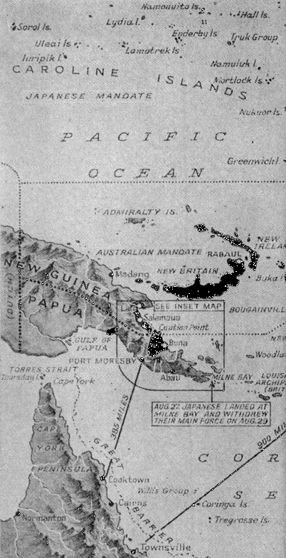 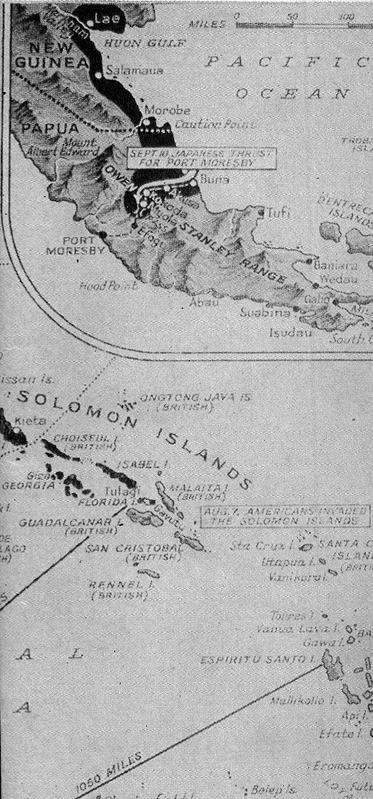 [Map source from: Pictorial History of the Second World War, Vol. 2, by Wm. H. Wise & Co., Inc., 1944] |
![]() Back to 1943 - Part 1
Back to 1943 - Part 1
![]() Next to
1943 - Part 2
Next to
1943 - Part 2